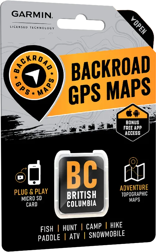

British Columbia Backroad GPS Map (8GB SD Card) | Garmin Compatible Navigation
British Columbia Backroad GPS Map (8GB SD Card) | Garmin Compatible Navigation is backordered and will ship as soon as it is back in stock.
Delivery and Shipping
Delivery and Shipping
Canada: Free standard shipping on orders over $150 to BC, AB, SK, MB, and ON
Delivery Times
Canada: 3-7 business days after processing.
United States: 5-10 business days after processing.
Payment & Security
Payment methods
Your payment information is processed securely. We do not store credit card details nor have access to your credit card information.
Conquer BC’s Wildest Frontiers — Navigate Without Limits
When you're deep in BC’s legendary backcountry — from the towering Rockies to the remote islands of Haida Gwaii — reliable, detailed navigation is mission-critical.
The British Columbia GPS Map (8GB SD Card) is the ultimate survivalist tool, offering full-scale city and wilderness navigation for your Garmin GPS device, far beyond the reach of cell service.
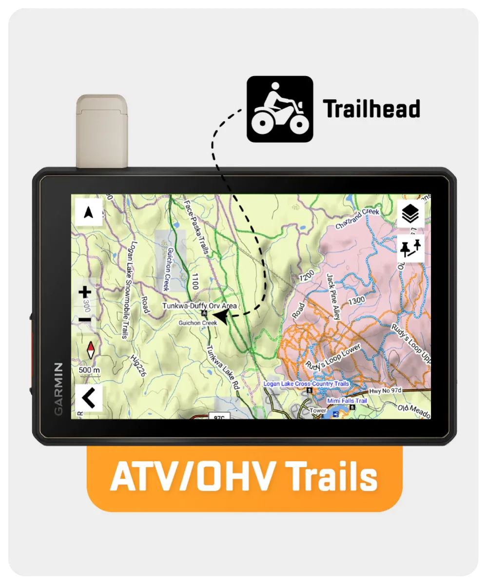
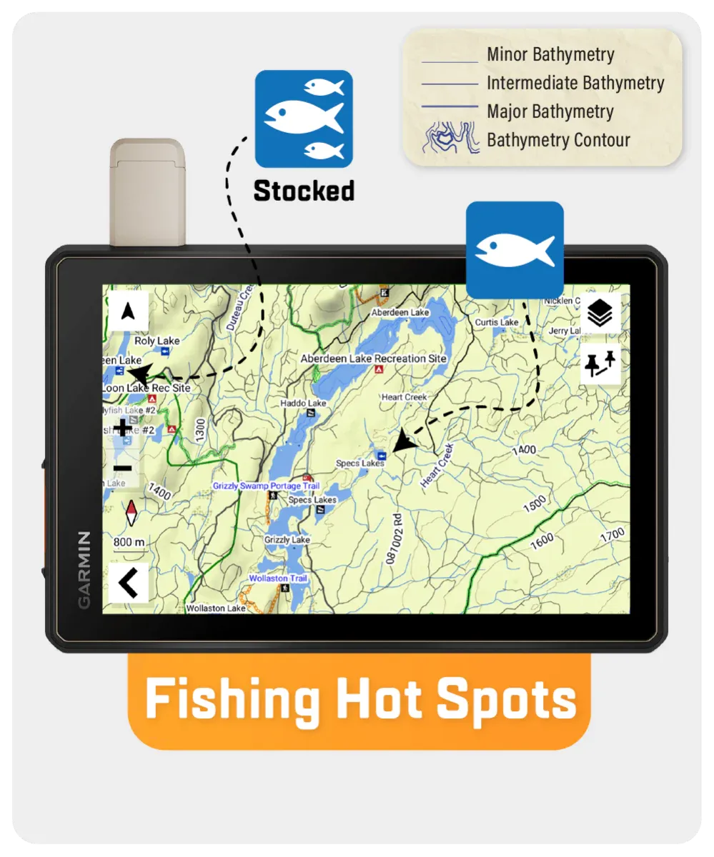
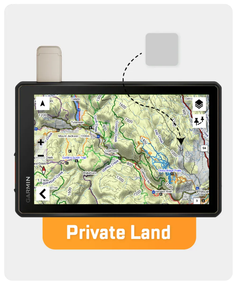
Packing over 685,000 km of mapped backroads — including 200,000 km of routable roads — this GPS map integrates wildlife zones, Crownland and private leased land for hunters and anglers, oil and gas facility locators, detailed lake depth contours, updated trail systems, and so much more.
Whether you're prepping for an off-grid expedition, scouting hunting grounds, or navigating BC's vast, untamed wilderness, this is your essential tactical advantage.
Key Features for Survival, Hunting, and Adventure:
- 685,000+ km of backroads; 200,000+ km routable for reliable movement
- 23,000+ km of named and enhanced Forest Service Roads
- Wildlife Management Units (WMUs) for precise hunting strategy
- 1,800+ lakes and rivers mapped with bathymetric contours
- Oil & gas grids and resource facility locations for off-grid reference
- 4,400+ km of updated ATV and snowmobile routes
- Tens of thousands of fishing hotspots, parks, trails, and campsites
- Enhanced First Nations reserve mapping and rail mile markers
- Updated snowmobile trail styles for easier winter navigation
However, it’s important to note that some units may experience issues with display or feature availability, depending on the model version.
You can check if your unit is compatible here.
| Specification | Details |
|---|---|
| Map Format | 8GB SD Card (includes Micro-SD Adapter) |
| Map Scale | Dynamic Scale |
| Version | V2025 |
| Coverage | Vancouver Island, Vancouver Coast & Mountains, Thompson Okanagan, Kootenay Rockies, Cariboo Chilcotin Coast, Northern BC |
| Compatibility | Most Garmin GPS devices (2012 and newer) |
| Language | English Mapping Text |
| Backroad Network | 685,000+ km (200,000+ km routable) |
| Trail Coverage | Tens of thousands of km for hiking, paddling, biking, ATV, snowmobiling |
| Bathymetry Data | 1,800+ lakes, rivers, and streams |
| Wildlife Management Units | Included |