Canadian Rockies Backroad Mapbooks – 4th Edition | BRMB
Canadian Rockies Backroad Mapbooks – 4th Edition | BRMB is backordered and will ship as soon as it is back in stock.
Delivery and Shipping
Delivery and Shipping
United States: Free standard shipping on orders over $200.
Canada: Free standard shipping on orders over $100 to BC, AB, SK, MB, and ON
Delivery Times
Canada: 3-7 business days after processing.
United States: 5-10 business days after processing.

Payment & Security
Payment methods
Your payment information is processed securely. We do not store credit card details nor have access to your credit card information.
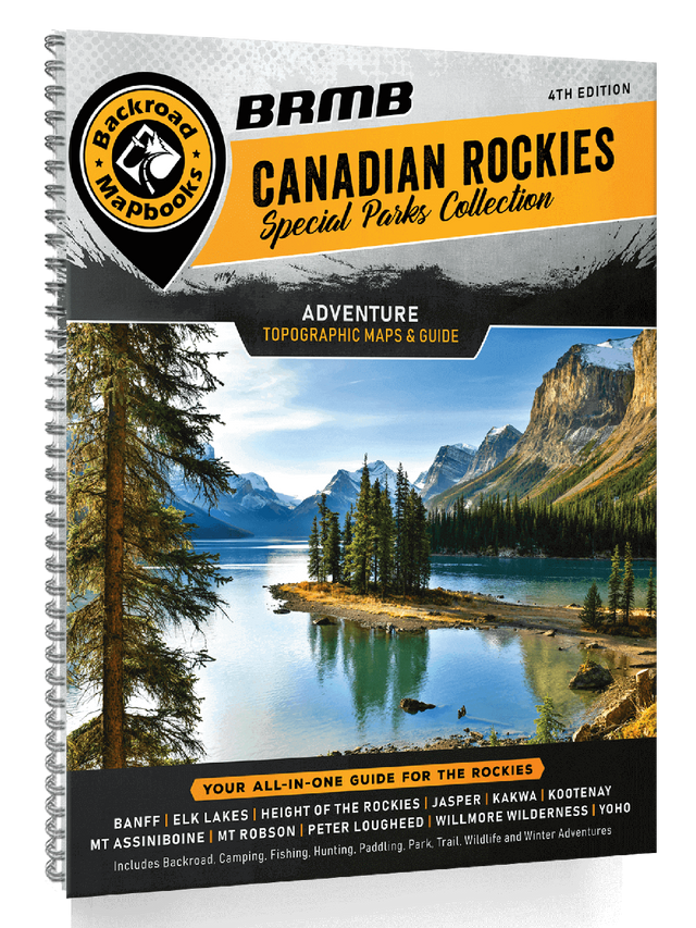
Unlock the secrets of Canada’s most breathtaking wilderness with the 4th Edition of our Canadian Rockies Backroad Mapbooks. This special edition delves deep into the extensive network of national and provincial parks—spanning over 30,000 square kilometres—offering an indispensable guide for explorers of all levels. Experience detailed, state-of-the-art topographic maps, comprehensive park overviews, and meticulously researched adventure listings that highlight everything from hiking trails to camping sites, fishing spots, and even winter activities.
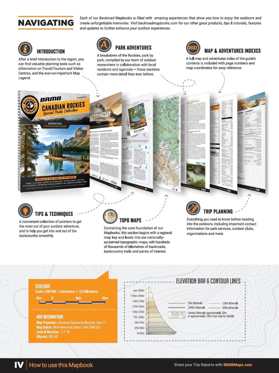
Designed with clarity and user-friendliness in mind, the mapbook presents a well-organized breakdown of the region’s gems such as Banff, Jasper, Kootenay, and Yoho National Parks, along with major provincial parks. Whether you’re planning a leisurely road trip or a challenging backcountry adventure, these pages provide essential insights, practical tips, and planning tools to maximize your Rockies experience. With detailed legends, map keys, and indices including adventure and trip-planning sections, this heavy-duty spiral-bound guide is your ultimate companion to traverse the wild beauty of the Canadian Rockies.
Key Features:
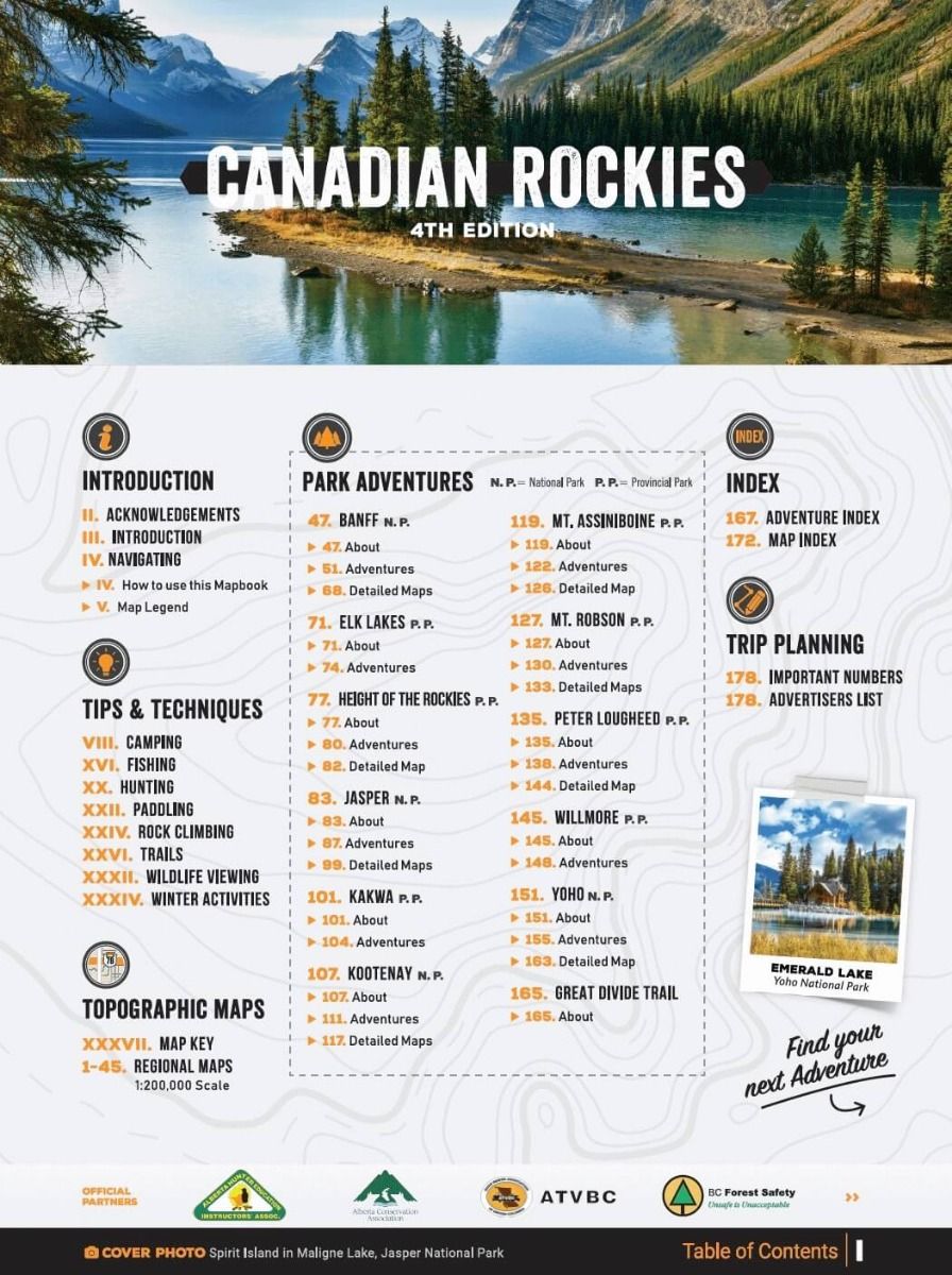
- Extensive Coverage: Detailed maps and information for 11 National and Provincial Parks, including Banff, Jasper, Kootenay, Yoho, and more.
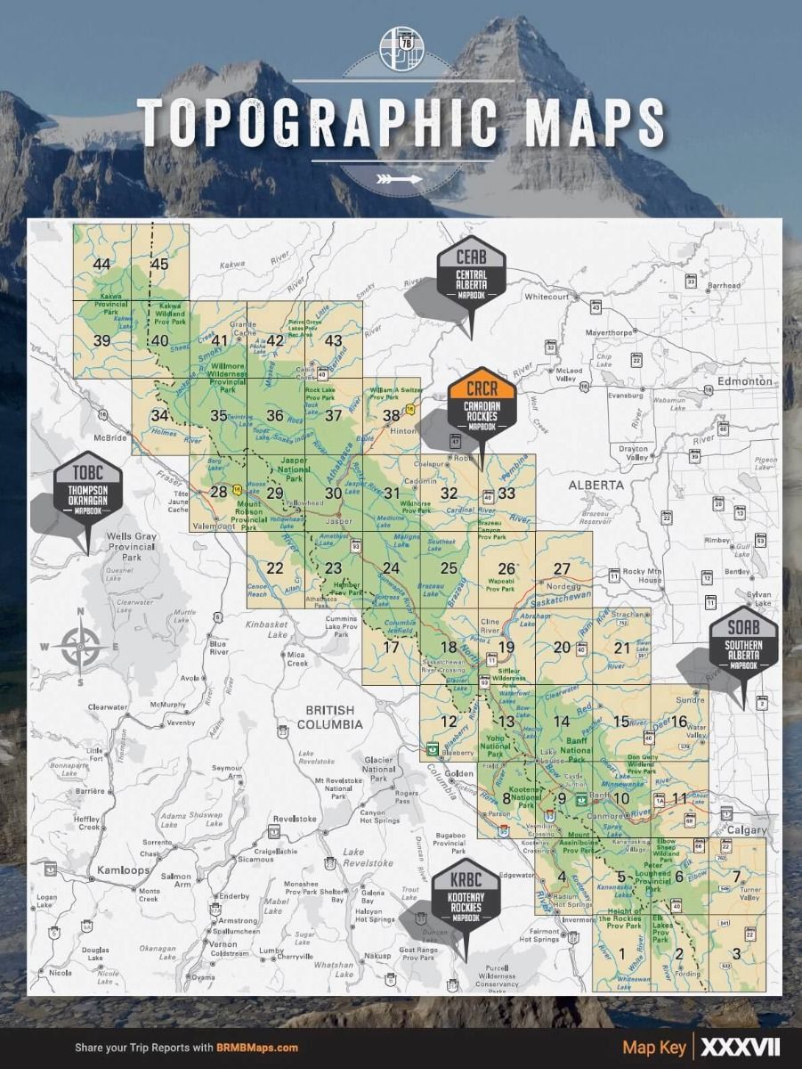
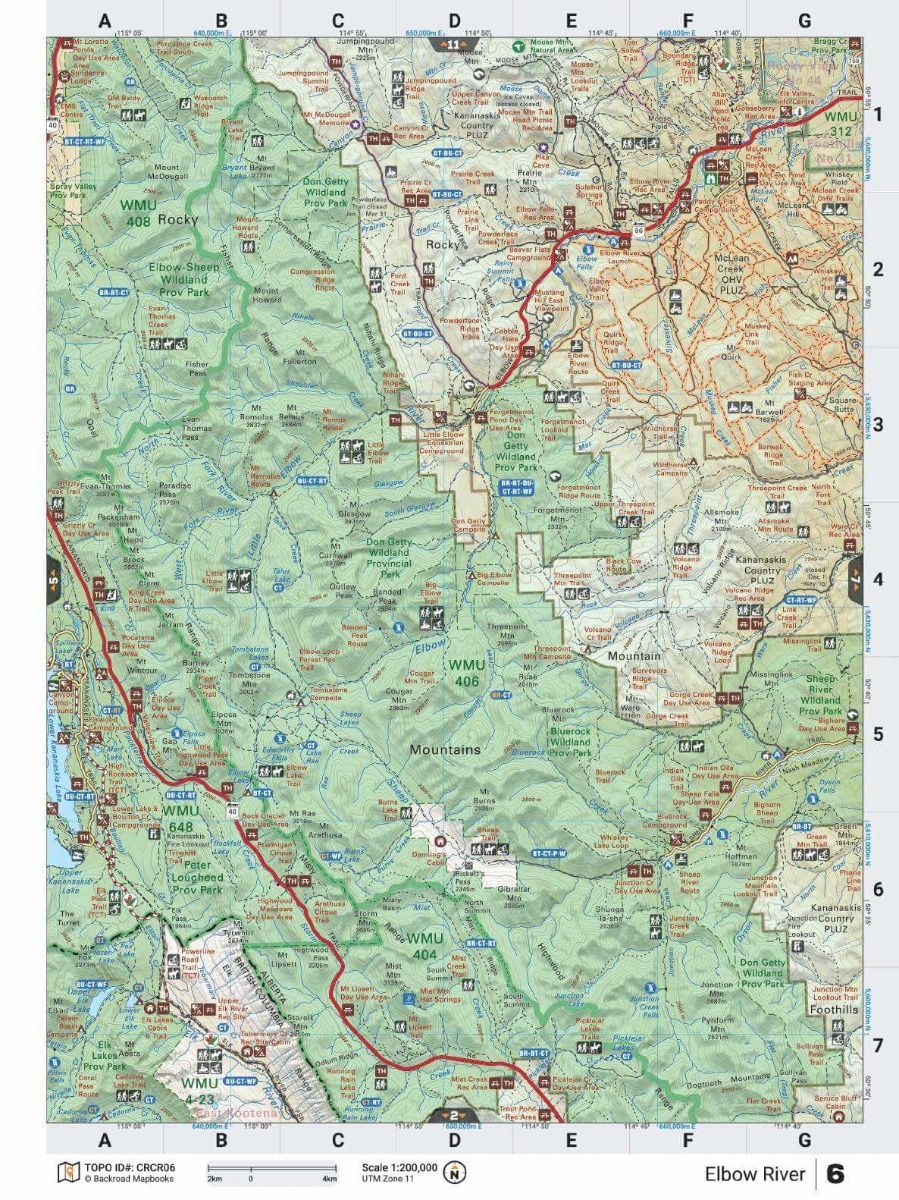
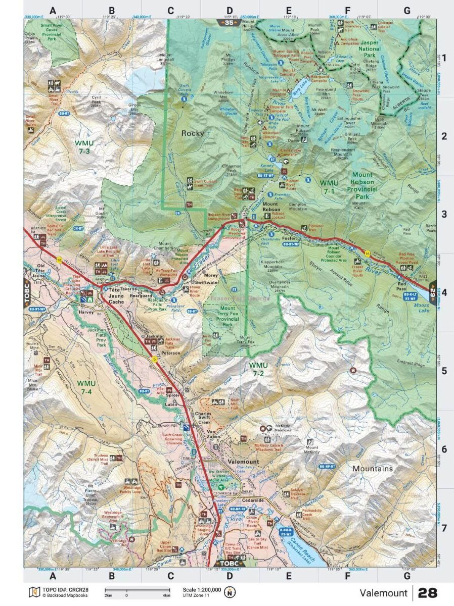
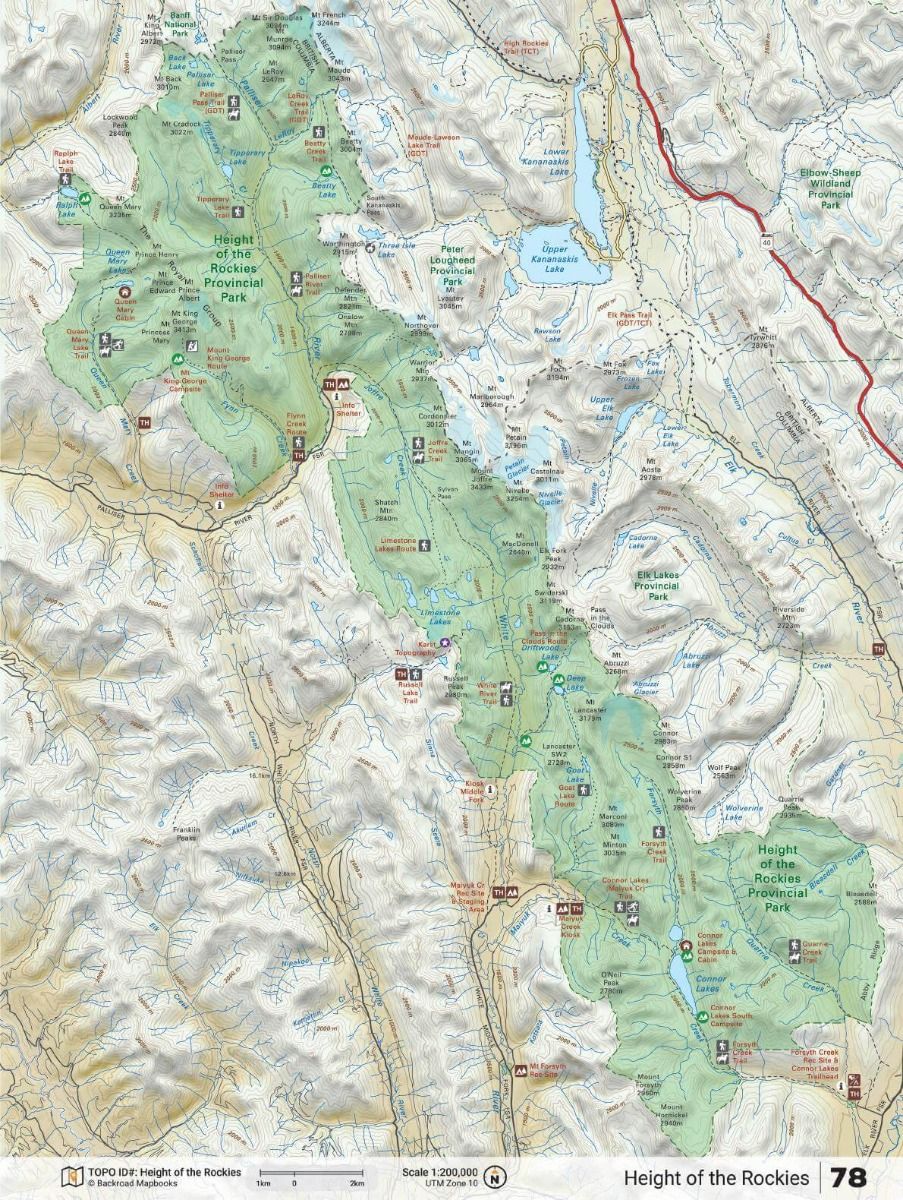
- Multi-Scale Maps: Features 71 maps across various scales – from park overviews to detailed topographic layouts for popular areas such as Lake Louise, Radium Hot Springs, and Jasper townsite.
- Advanced Planning Tools: Includes comprehensive park overviews, trail maps, camping details, and trip-planning indices to guide your adventure.
- Robust Design: Printed in a convenient 21.5 x 28 cm (8.5 x 11 inch) format with a heavy-duty spiral-bound cover for durability in rugged outdoor conditions.
- Enhanced Updates: Regular road and trail updates, refined campsite locations, new Points of Interest, and added features like fish species listings for enhanced outdoor exploration.
Print Features
- Map Key & Legend
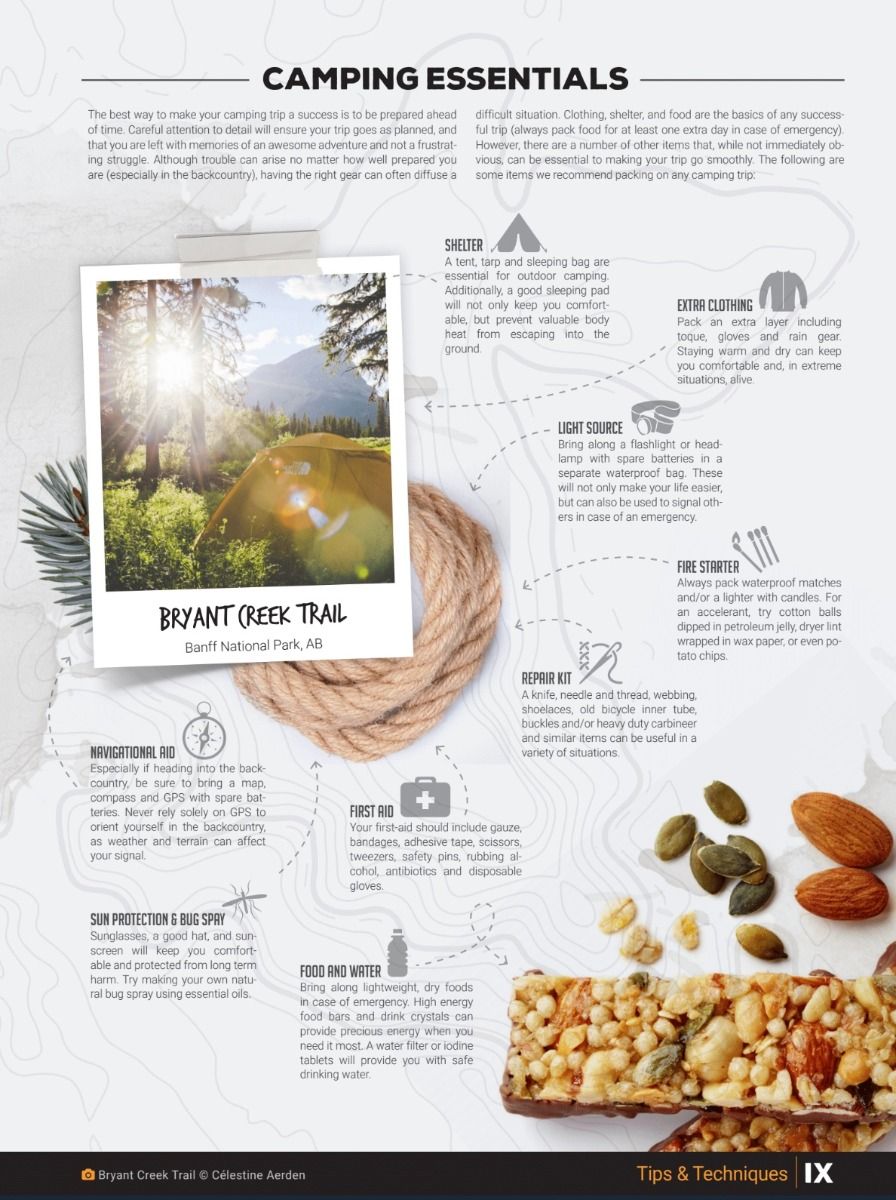
- Tips & Techniques / Adventure Featured
- Camping
- Fishing
- Hunting
- Paddling
- Rock Climbing
- Trails
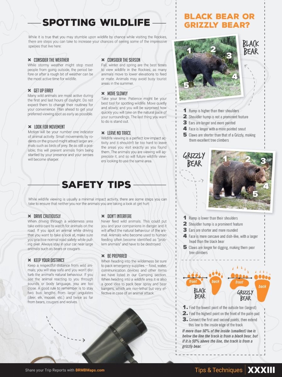
- Wildlife Viewing
- Winter Activities
- Topographic Maps
- 45 @ 1:250,000 Scale Maps
- 26 Overview and Detailed Park & Topographic Maps of various scales
- Banff National Park - 1:750,000 park overview map 3 detailed topographic maps ranging from 1:50,000 to 1:110,000 for Banff townsite, Canmore to Minnewanka Lake & Lake Louise area
- Elk Lakes Provincial Park - 1:90,000 detailed topographic park map
- Height of the Rockies Provincial Park - 1:200,000 park map plus a 1:80,000 scale Connor Lakes area topographic map
- Jasper National Park - 1:900,000 park overview map 2 detailed topographic maps ranging from 1:50,000 to 1:80,000 for Jasper townsite & Maligne Lake area
- Kakwa Inter-Provincial - 1:270,000 topographic park map
- Kootenay National Park - 1:300,000 park overview map 2 detailed topographic maps ranging from 1:15,000 to 1:50,000 for Radium Hot Springs and Marble Canyon areas
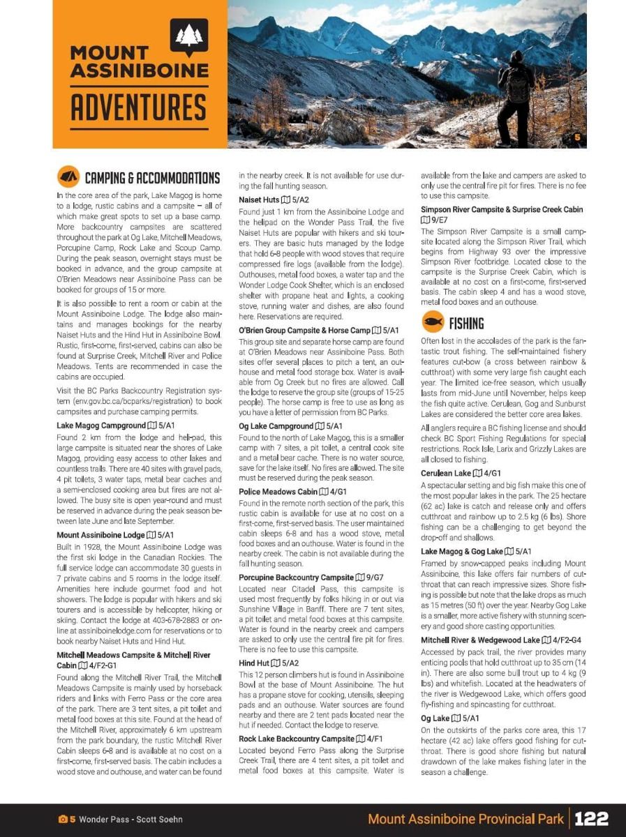
- Mount Assiniboine Provincial Park - 1:130,000 detailed park map plus a 1:50,000 scale Lake Magog area topographic map
- Mount Robson Provincial Park - 1:380,000 topographic park map, Berg Lake Trail (1:50,000), Yellowhead Lake (1:30,000), Robson River and Meadows Campgrounds (1:17,000)
- Peter Lougheed Provincial Park - 1:170,000 park map plus a 1:60:000 scale Kananaskis Lakes area topographic map
- Willmore Provincial Park - 1:600,000 park map
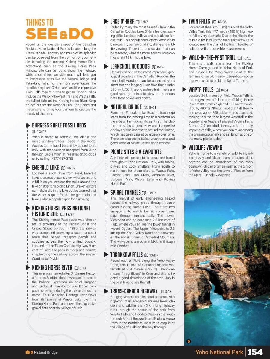
- Yoho National Park 1:220,000 park map 3 detailed topographic maps ranging from 1:40,000 to 1:100,000 for Field-Emerald Lake-Yoho Valley and Lake O'Hara areas
- Parks Featured
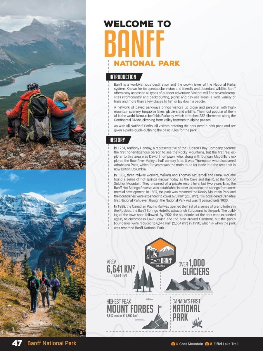
- Banff National Park
- Elk Lakes Provincial Park
- Jasper National Park
- Kakwa Wildland Provincial Park
- Kootenay National Park
- Mount Assiniboine Provincial Park
- Mount Robson Provincial Park
- Peter Lougheed Provincial Park
- Willmore Wilderness Provincial Park
- Yoho National Park
- Great Divide Trail
- Index
- Adventure Index
- Map Index
- Trip Planning Tools