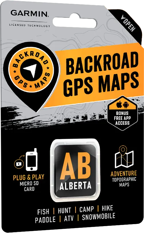
Alberta Backroad GPS Map (8GB SD Card) | Garmin Compatible Navigation
Alberta Backroad GPS Map (8GB SD Card) | Garmin Compatible Navigation is backordered and will ship as soon as it is back in stock.
Delivery and Shipping
Delivery and Shipping
United States: Free standard shipping on orders over $200.
Canada: Free standard shipping on orders over $100 to BC, AB, SK, MB, and ON
Delivery Times
Canada: 3-7 business days after processing.
United States: 5-10 business days after processing.

Payment & Security
Payment methods
Your payment information is processed securely. We do not store credit card details nor have access to your credit card information.
Survive and Thrive from Rockies to Prairie
From the towering peaks of the Rockies to the endless plains of the north, Alberta’s wild lands demand serious navigation — and when you’re off the grid, precision matters.
The Alberta GPS Map (8GB SD Card) empowers you with the most detailed, rugged-ready mapping tool available for your Garmin device, built for true survivalists and adventurers.
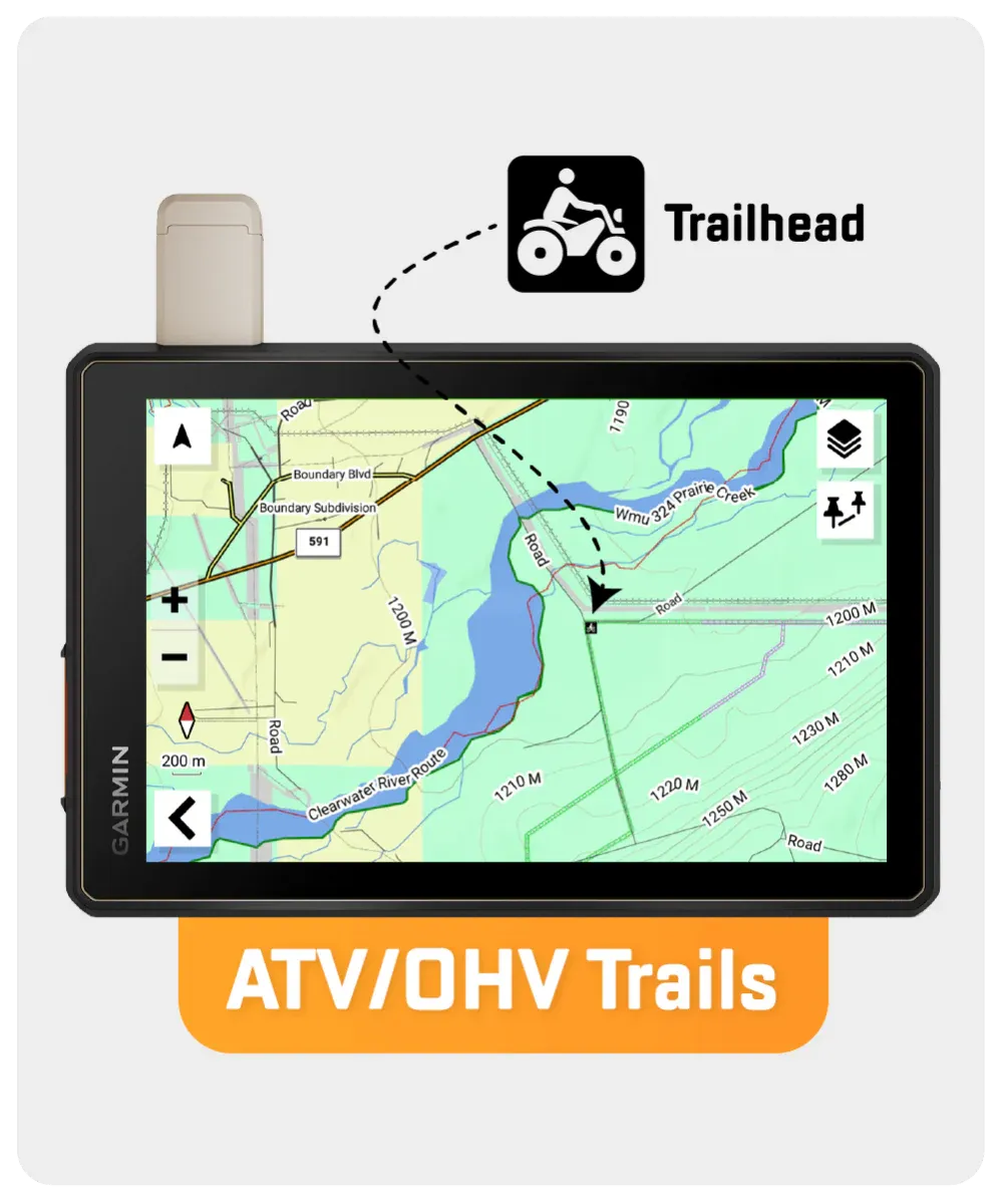
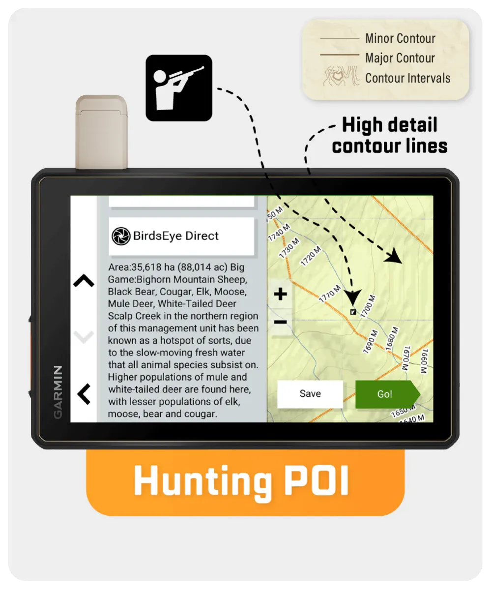
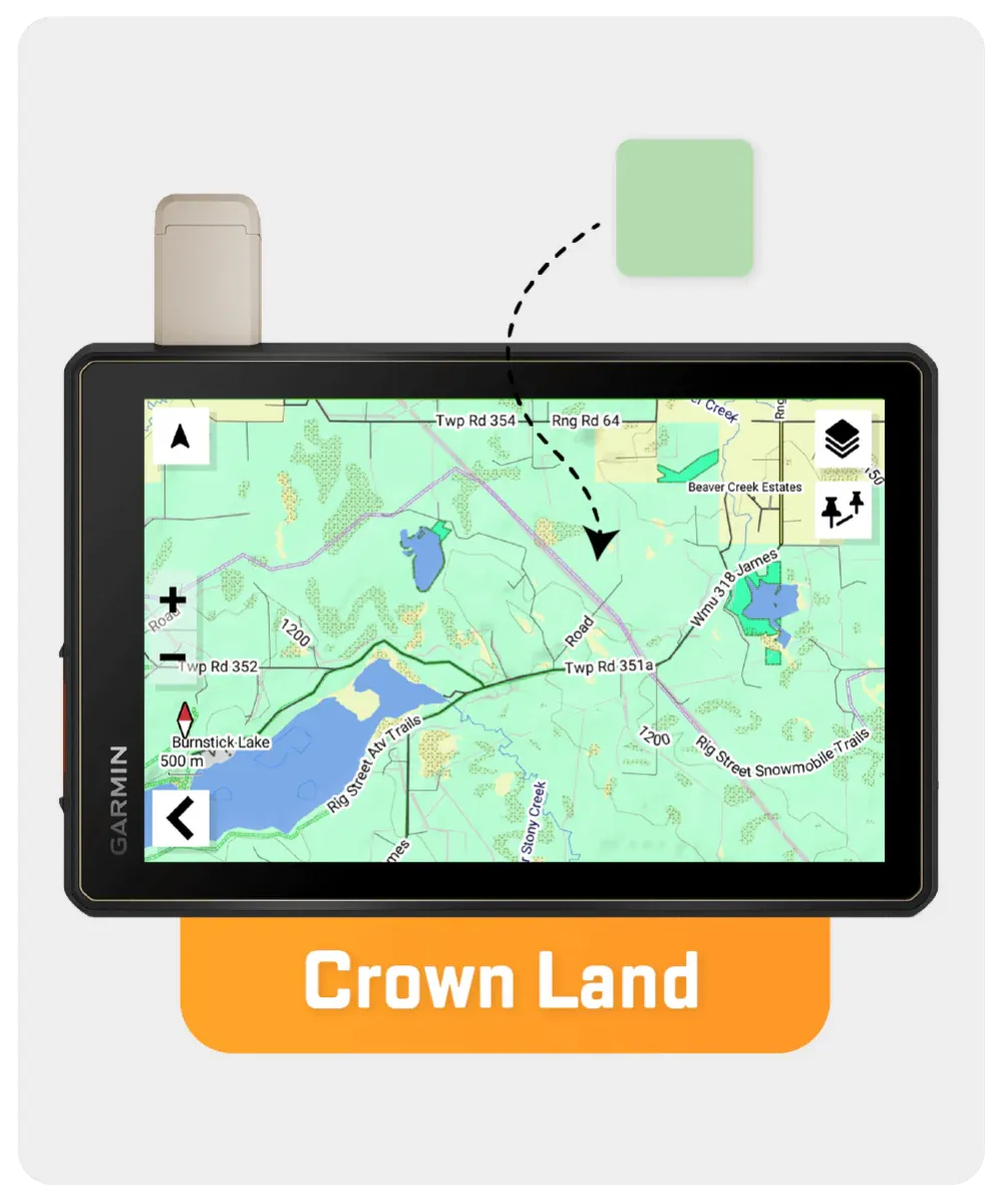
Combining over 410,000 km of mapped backroads — including 320,000 km of routable roads — this tactical resource marks critical wilderness features like Wildlife Management Units (WMUs), searchable Oil & Gas LSD grids, ATV and snowmobile routes, fishing lakes, trailheads, and even First Nations reserve lands.
Whether you're setting camp deep in muskeg country, tracking through foothills, or navigating snow-packed backroads, the Alberta GPS Map V2025 ensures you stay sharp, stay mobile, and stay alive.
Key Features for Wilderness Survival:
- 410,000+ km of mapped backroads; 320,000+ km routable
- WMUs marked for strategic hunting and tracking
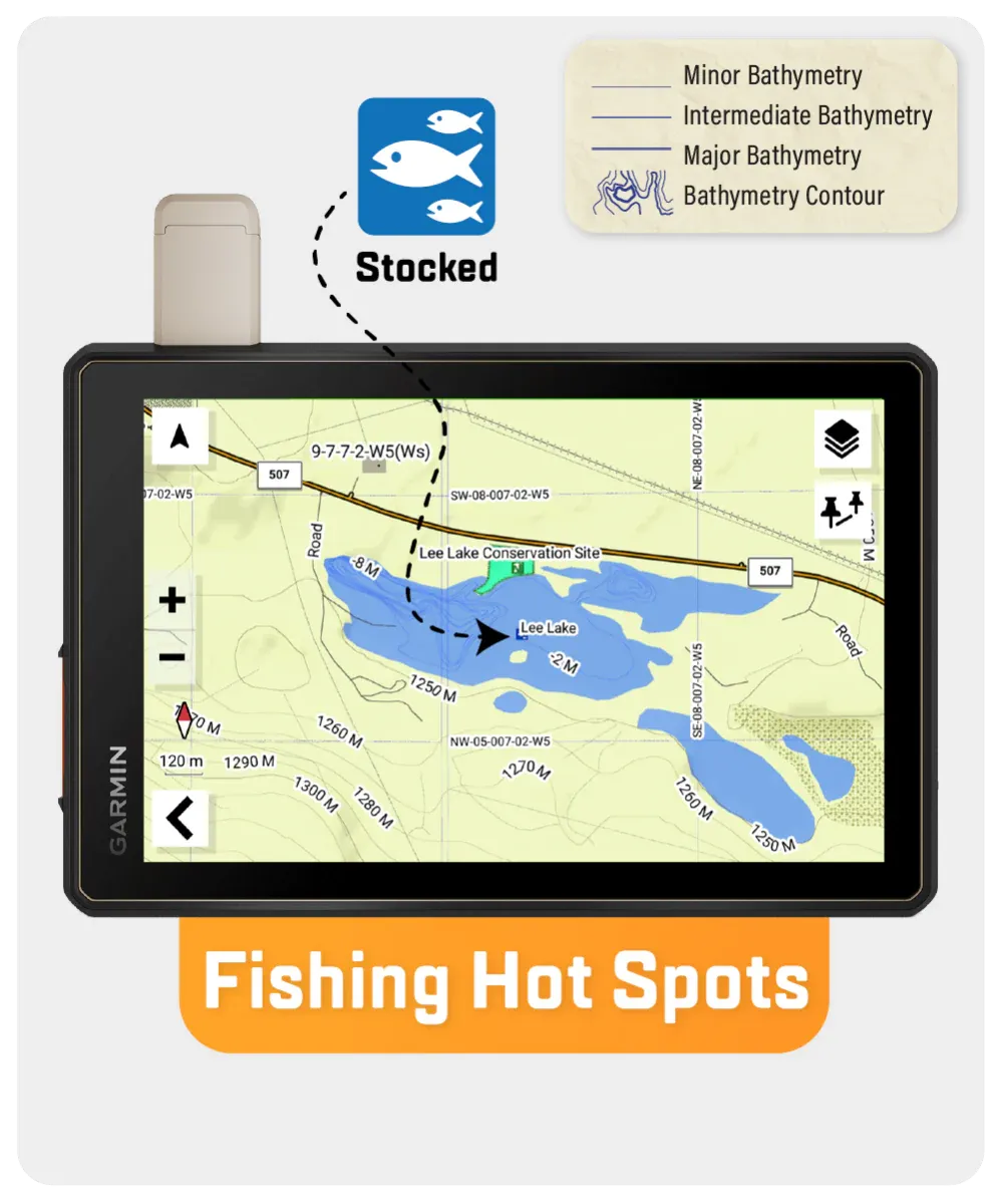
- Bathymetric lake depth data for 150+ fishing waters
- 2,800+ km of updated ATV and snowmobile trails
- Full address, township, and range search capabilities
- Oil and gas facility locations for emergency reference
- Thousands of hiking, biking, skiing, and paddling routes
- Crown land and conservation areas clearly mapped
- Enhanced cartography with topographic precision
However, it’s important to note that some units may experience issues with display or feature availability, depending on the model version.
You can check if your unit is compatible here.
| Specification | Details |
|---|---|
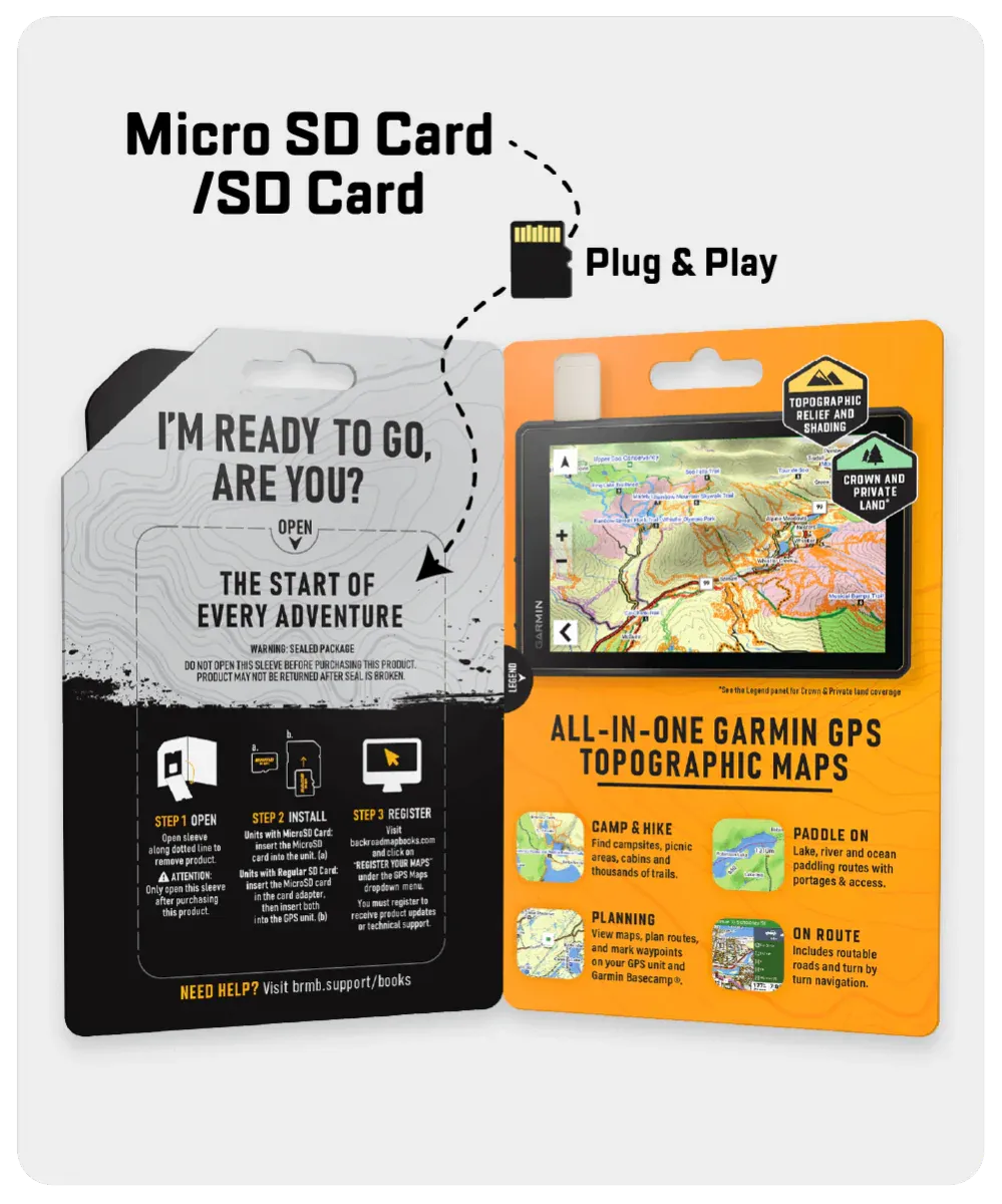
| Map Format | 8GB SD Card (includes Micro-SD Adapter) |
| Map Scale | Dynamic Scale |
| Version | V2025 |
| Coverage | Southern, Central, Northern Alberta, Canadian Rockies |
| Compatibility | Most Garmin GPS devices (2012 and newer) |
| Language | English Mapping Text |
| Backroad Network | 410,000+ km (320,000+ km routable) |
| Trail Coverage | Tens of thousands of km for hiking, biking, skiing, paddling, ATV |
| Wildlife Management Units | Included with detailed species and zoning info |
| Bathymetry Data | 150+ fishing lakes, rivers, and streams |